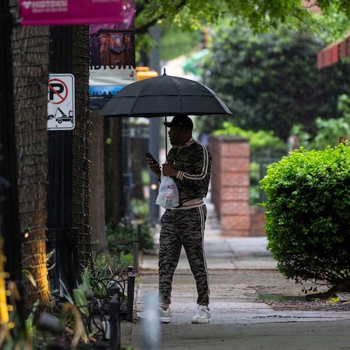
Unusually cool, rainy conditions continue across Georgia on Monday, making for a soggy first day of school for the Peach State’s largest districts.
Highs are not expected to break 70 degrees, and a flood watch that covers all of metro Atlanta and the state’s western half remains in effect until 8 p.m., according to the National Weather Service.
“Excessive runoff may result in flooding of rivers, creeks, streams and other low-lying and flood-prone locations,“ the Weather Service warns. Urban areas with poor drainage are also at risk.
Many areas have already seen 1-3 inches of rain since Saturday, and another 1-3 inches could fall Monday. Some locations could even get up to an additional 6 inches.
In Covington, city officials said about 30 people were temporarily evacuated Sunday from their homes in the Nixon Circle area because of isolated flash flooding. Water levels quickly receded, and residents were allowed to return to their houses.
The flash flood warnings stretch into the Florida Panhandle and the eastern half of Alabama, where at least one person died Sunday morning when quickly rising water overwhelmed a vehicle carrying two people. The second person was rescued from a tree, according to the National Weather Service.
On Monday, temperatures will stay in the mid-60s as scattered showers fall throughout the day, so kids will need a sweater and a rain jacket as they head home from school. Atlanta Public Schools as well as the Clayton, Cobb, DeKalb, Fayette, Fulton, Gwinnett and Rockdale county systems all start classes Monday.
“This is really unusual weather for the month of August,” Channel 2 Action News meteorologist Brian Monahan said. “(It) could be our coolest day in about 12 years.”
Aug. 17, 2013, was the last time the month saw highs stay below 70 degrees in metro Atlanta.
“This gives you an idea of how rare this is,” Monahan said. “Crazy change in the weather, right? From all the heat we saw just a week ago.”
Last week, the city hit 100 degrees for the first time this year. The high temperatures coupled with high humidity caused heat indexes of 105 degrees or more, sparking heat advisories that covered much of the state.
The cool trend is expected to continue the next several days. Each day will be gradually warmer, but temps will stay below normal at least through next weekend, according to forecasters.
About the Author
Keep Reading
The Latest
Featured


